Ecoation Robotics
Ecoation build B2B SAAS solutions generating actionable insights for commercial greenhouse farmers, increasing yields while reducing operating costs and pesticide use. As Senior Product Design Manager, I designed and built a system leveraging robotic data collection to enable machine learning based analytics to forecast harvests, model the spread of pests and disease and optimise crop interventions for plant health.

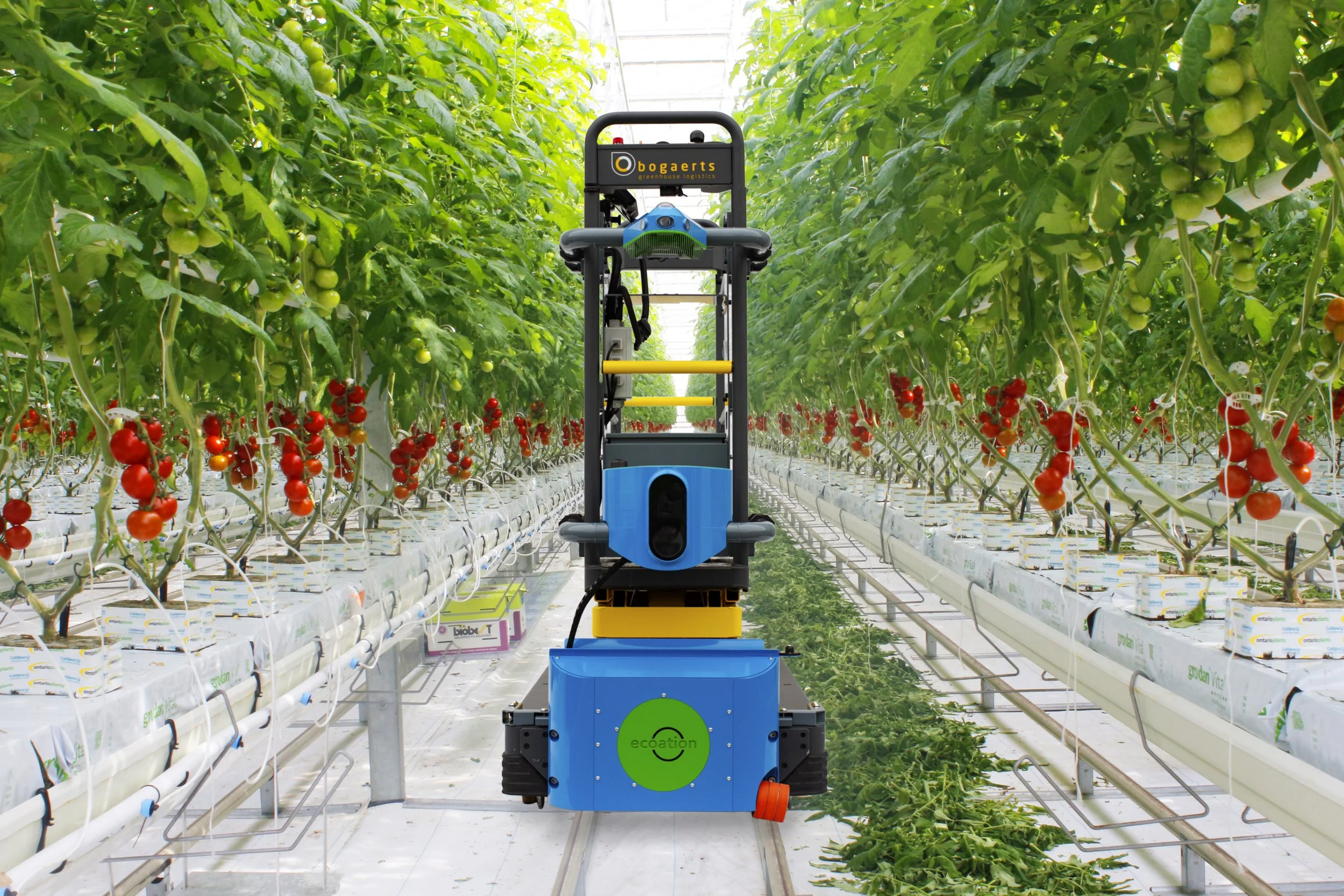
A co-bot approach for data collection was taken to fit with existing processes used in commercial greenhouses not yet targeted for automation, such as crop work, and reduce startup cost to remove barriers to adoption. Customers existing scissor lifts were fitted with in-house designed 360° stereo-depth cameras paired with local machine learning based analytics to enable operation in data constrained environments. An on-site server was used to colate data and buffer cloud communication.

Successive versions of the technology were released every few months based on market feedback, changing business requirements and in response to the COVID19 related supply chain challenges. Flexible designs ensured continuity and reducing costs by 30%, manufacturing time by 80%, and failure rates by 30%. This enabled scaling from 10s of customers locally to 100s worldwide.
As a result of this work, I am the named author on 3 patents covering the collection, analysis and use of very high spatial resolution climate data which is possible to collect when sensors are mounted on a vehicle which travels through the greenhouse as opposed to fixed in a small number of select locations.
-
An apparatus includes at least one processor configured to obtain stereo-spatio-temporal data measurements of plants in a growing area. The stereo-spatio-temporal data measurements include (i) first spatio-temporal data measurements of the plants in the growing area and (ii) second spatio-temporal data measurements of the plants in the growing area. The at least one processor is also configured to analyze the stereo-spatio-temporal data measurements to identify one or more actual or potential problems associated with one or more of the plants. The at least one processor is further configured to generate a graphical user interface identifying at least one of the one or more actual or potential problems with the one or more plants. The first and second spatio-temporal data measurements of each stereo-spatio-temporal data measurement are associated with at least one common plant characteristic and different three-dimensional positions within the growing area taken at one or more known times.
-
A method includes receiving manual input from a human operator, where the manual input includes human observation data measurements associated with plants in a growing area. The method also includes, for each human observation data measurement, identifying a height of a movable portion of a mobile platform on which the human operator rides, identifying a location of the mobile platform in the growing area, identifying a time at which the human observation data measurement is received, and associating the human observation data measurement with a three-dimensional position within the growing area and the time in order to generate a spatio-temporal data measurement. The three-dimensional position includes the height and the location. The method further includes storing, processing, or transmitting at least some of the spatio-temporal data measurements or one or more results based on at least some of the spatio-temporal data measurements.
-
A mobile platform includes at least one first sensor mounted at a first position on the mobile platform and at least one second sensor mounted at a second position on the mobile platform, where the first position is offset from the second position. The at least one first sensor is configured to capture first data measurements of plants in the growing area. The at least one second sensor is configured to capture second data measurements of the plants in the growing area. Each of the first and second data measurements is associated with a three-dimensional position within the growing area and a time. The first and second sensors are configured to generate at least one common type of data measurement such that at least some of the first and second data measurements represent stereo-spatio-temporal data measurements of the plants in the growing area.